

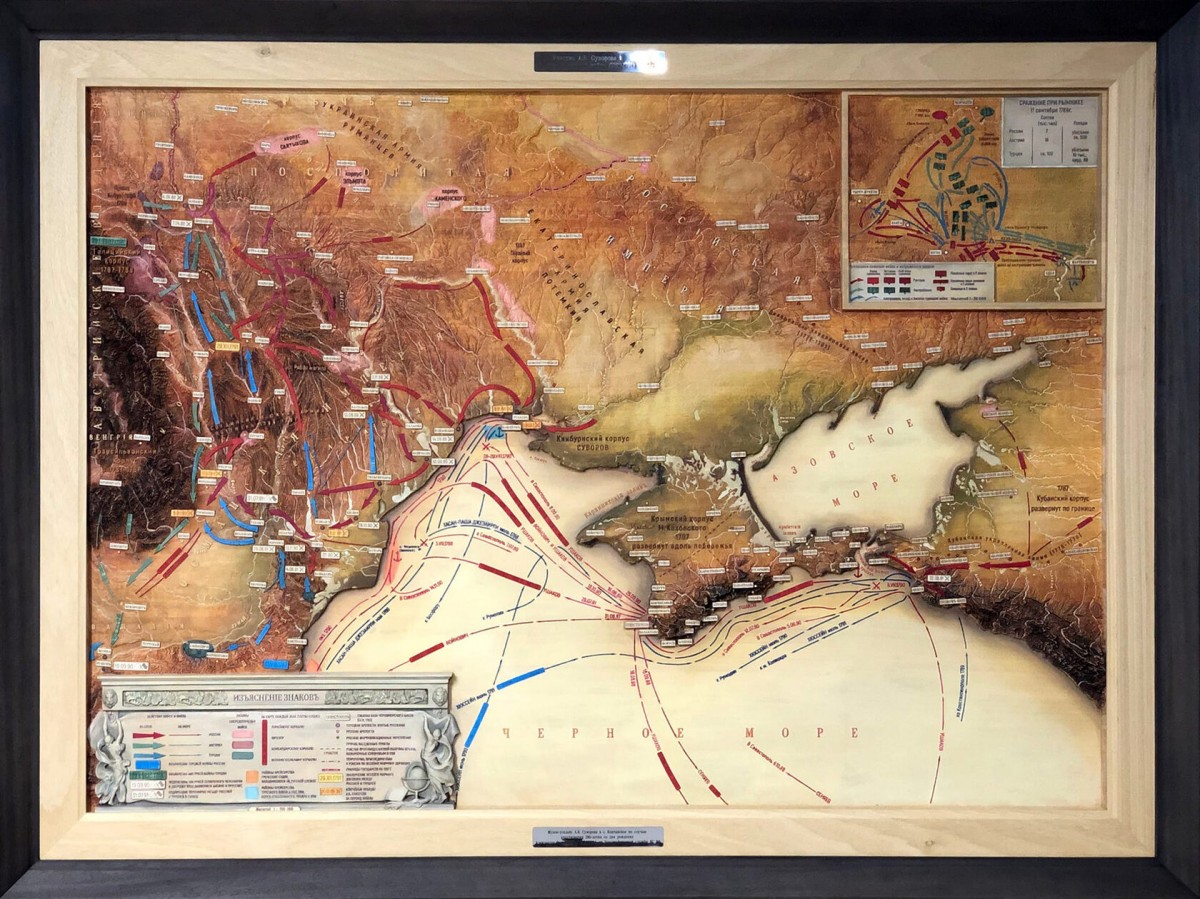
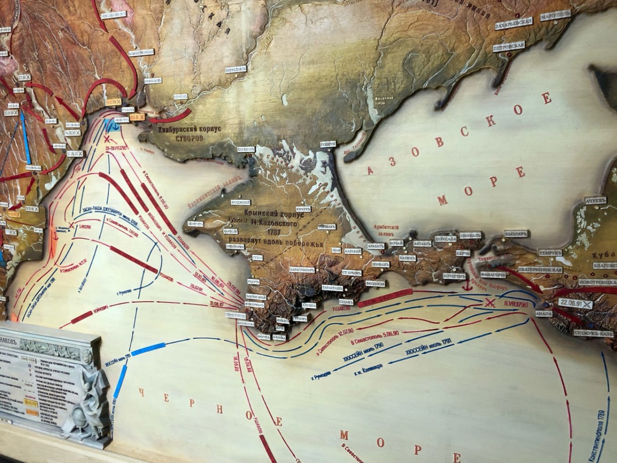
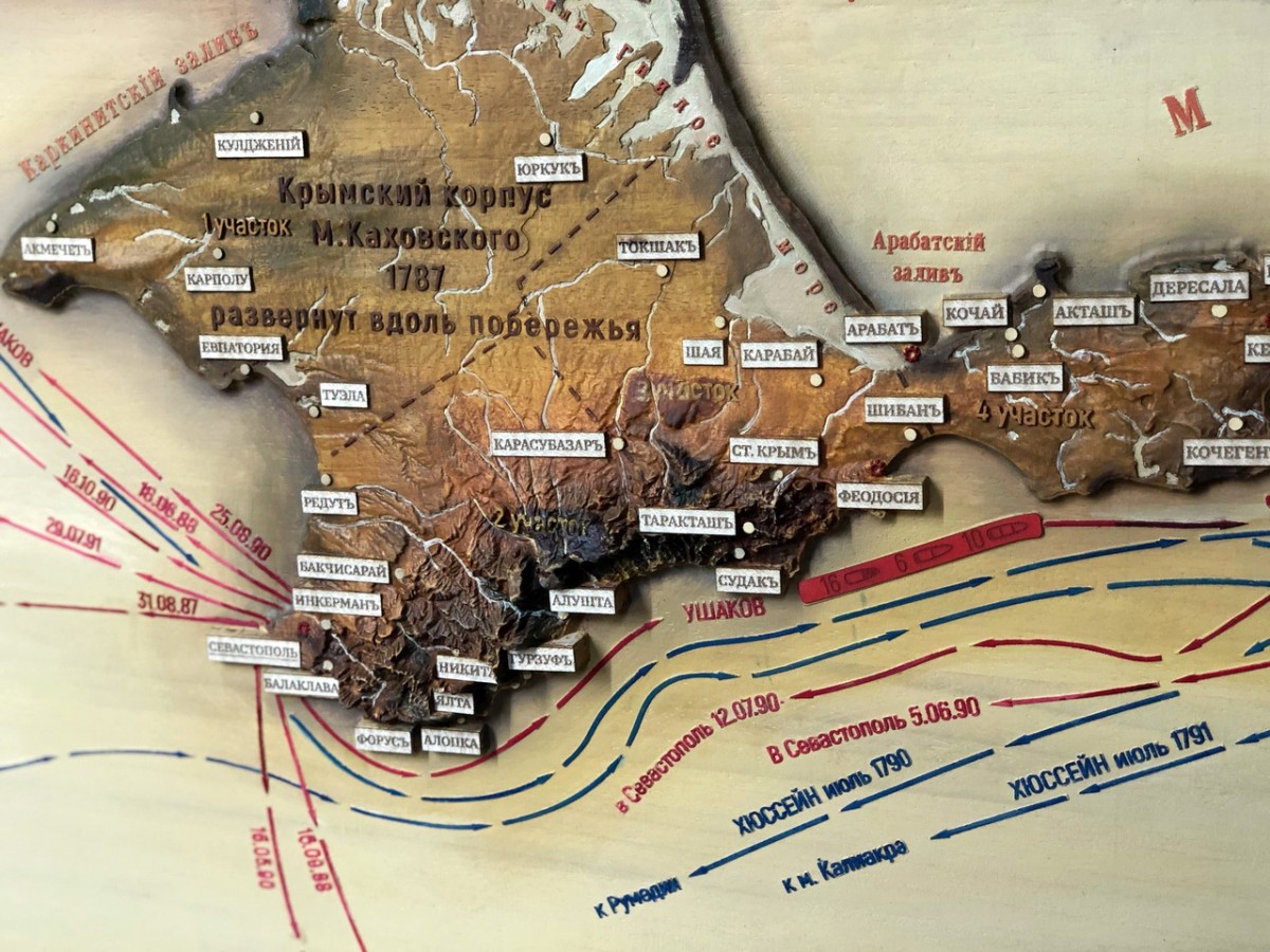
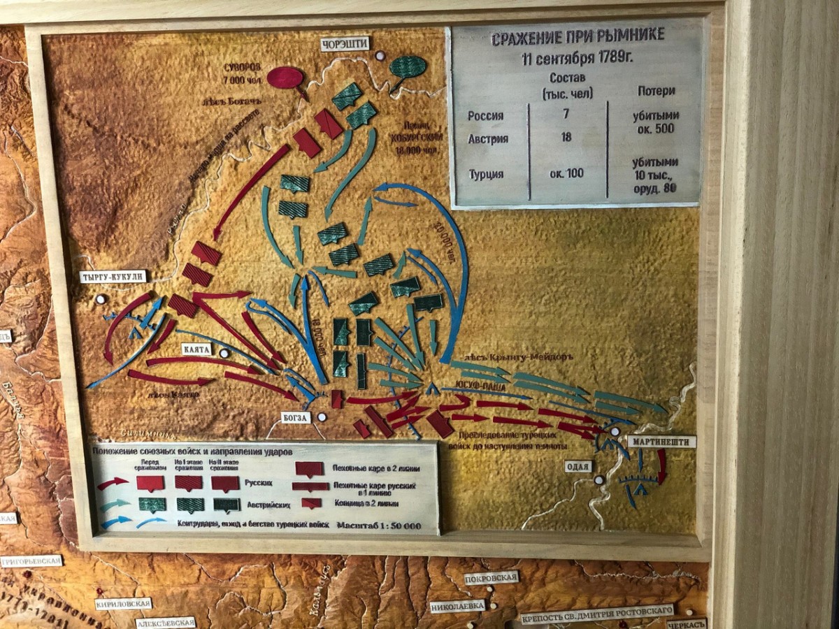
The map covers the entire theater of the war of the Allied empires against Turkey in 1787-1791 and reflects the special role of A.V. Suvorov in her victorious outcome. All geographical names, preserving the original spelling, were transferred from the archival maps of the 18th century, covering the territories of the Yekaterinoslav governorship (with the acquired territories), the Tauride province, the Caucasian and other lands. Details of military operations at sea and land are shown in detail, aggregating information from historical and modern maps of this war.
The relief of the map is based on the materials of modern satellite imagery SRTM, on the inset map (the battle of Rymnik) - on the basis of high-resolution imagery from ALOS PALSAR.
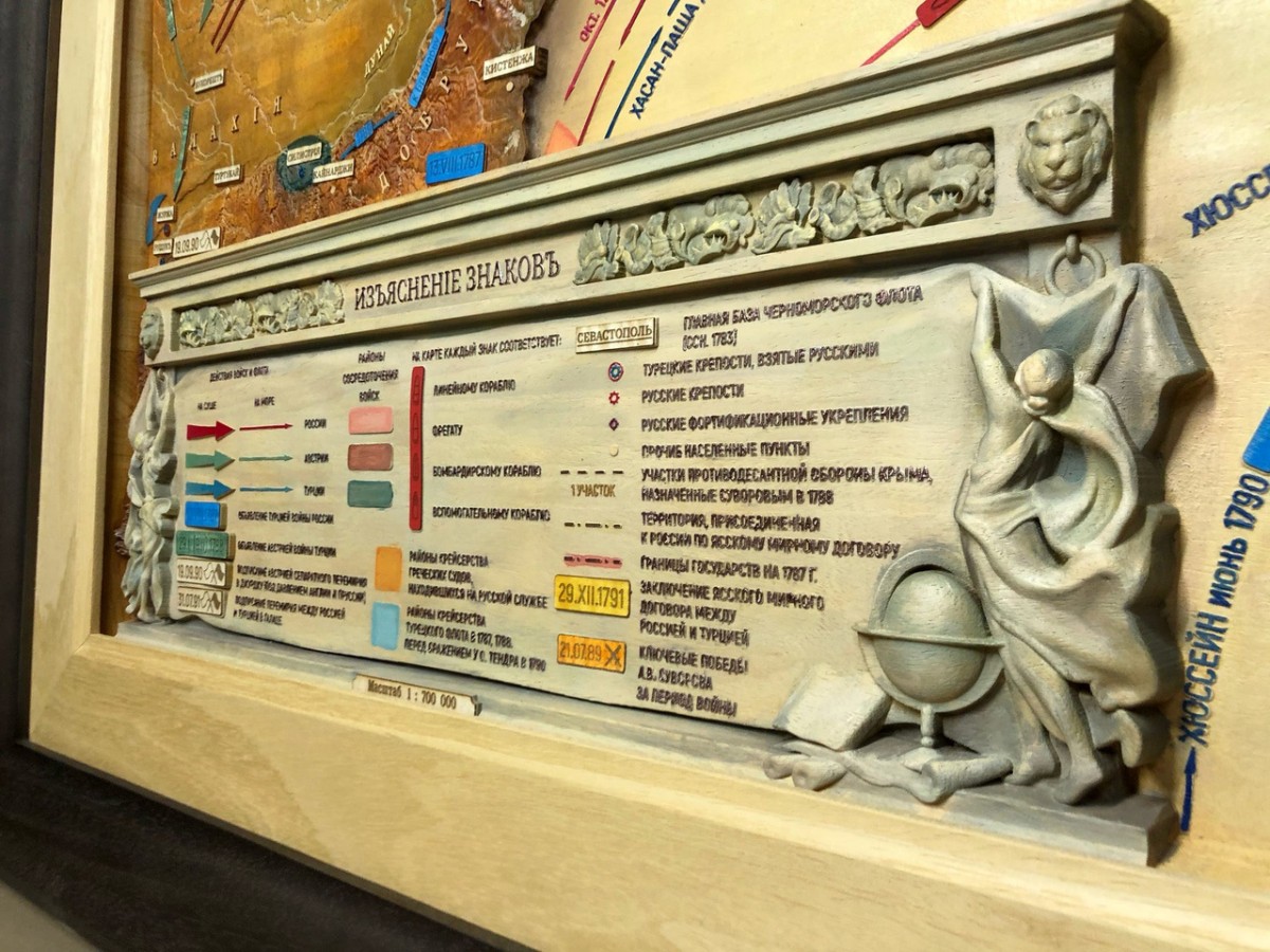
The map is made in the normal conical equidistant projection of Kavraisky, at a scale of 1: 700,000.
The map is carved from solid wood Abachi using automated high-precision equipment. Painted by hand with oil paints in grisaille colors.